English Travel Guide
Bukhansan Hike 2026: Baegundae by Subway, Free Entry, 2–4 Hours
진격의칼리
2026. 10. 31. 07:12
About five million people visit Bukhansan National Park, according to Wikipedia, and you can reach its trailheads by subway and bus.
That is the first thing to know before you plan a hike here: you do not need a car, a tour, or a permit.
The shortest classic route is the climb to Baegundae, the highest peak at 836.5 metres, and it takes roughly two to four hours round trip depending on where you start and how long the queue at the top is.
This guide is written for the next two weeks, when Korean travel media point to early November as the peak for the park's autumn colour.
I have pulled the numbers from the park's own history, transport details and several hiking guides, and I mark every spot where the sources disagree.
QUICK ANSWER
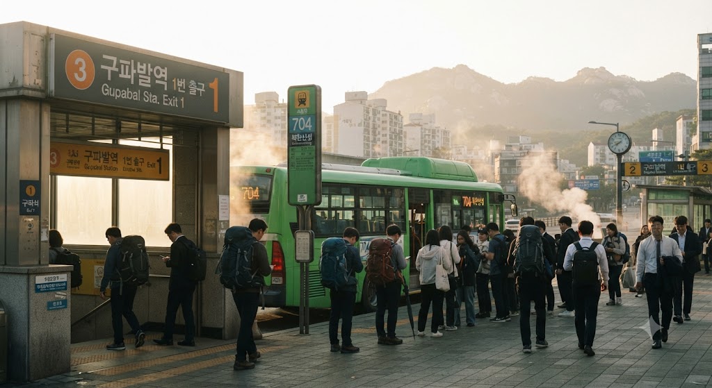
Take Seoul Subway Line 3 to Gupabal Station (Exit 1), then bus 704 toward the Bukhansanseong fortress, or head to the Ui-dong side for the shortest summit route. Entry to the park is free, no reservation is needed for Baegundae, and the last stretch to the top is bare granite with steel cables.
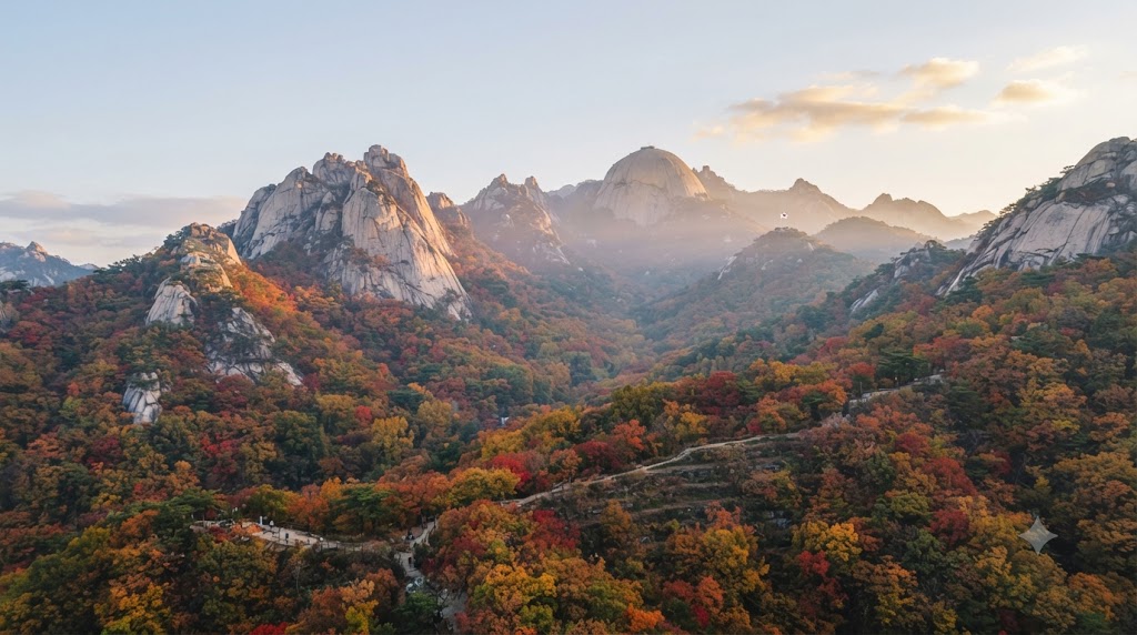
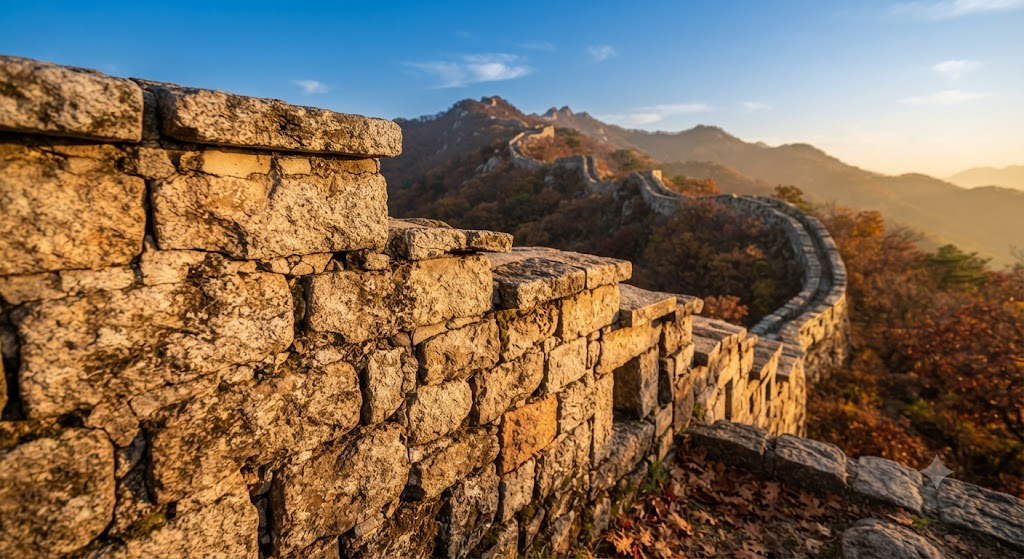
▲ Bukhansan in autumn (replace with your own photo)
01 /
What Bukhansan is, in four numbers
The park was designated on 2 April 1983 and covers roughly 80 square kilometres in northern Seoul and neighbouring Gyeonggi Province.
Three granite peaks define the skyline: Baegundae at 836.5 metres, Insubong at 810.5 metres and Mangyeongdae at 799.5 metres.
Insubong is a climbers-only peak with no walking trail, so when people say they hiked Bukhansan they almost always mean Baegundae.
The old name for the massif is Samgaksan, the three-horned mountain.
A fortress wall of about 9.5 kilometres runs along the ridges, first built in 132 AD according to Wikipedia and brought to its present size in 1711 under King Sukjong.
Some guides quote a shorter wall length, so treat any single figure as approximate.
02 /
Pick your route
Most visitors choose between a short summit climb and a long fortress walk.
The gap I noticed in most English guides is that they treat these as the same hike.
They are not: the Ui-dong summit route is a half-day climb, while the fortress circuit is a full day and far quieter at weekends.
If you have only one morning, choose Ui-dong. If you want the wall and the gates, give yourself the whole day.
They are not: the Ui-dong summit route is a half-day climb, while the fortress circuit is a full day and far quieter at weekends.
If you have only one morning, choose Ui-dong. If you want the wall and the gates, give yourself the whole day.
03 /
Getting there by subway and bus
Bus numbers and exit names have changed before, so check a live transit app on the morning of your trip.
The park office phone number given by one guide is +82 2-909-0497, which is useful if a trail closure is not clear online.
Driving is possible, but the park-run fortress car parks cost 2,000 won for the first hour according to one 2026 guide, and they fill early at weekends.
The park office phone number given by one guide is +82 2-909-0497, which is useful if a trail closure is not clear online.
Driving is possible, but the park-run fortress car parks cost 2,000 won for the first hour according to one 2026 guide, and they fill early at weekends.
04 /
The last stretch to Baegundae
Everything up to the Baegunbong-ammun gate is an ordinary mountain path.
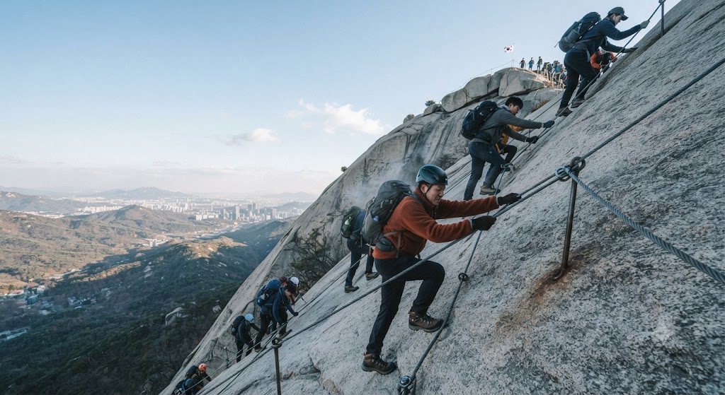
After that the trail turns to bare granite, with steel cables and railings, and your hands are in use for the final stretch.
One guide reports that the park added five safety railings in 2024 and separated up and down traffic, which helps, but weekend queues remain, especially on Sunday mornings in October.
No equipment or reservation is required for the summit.
If the rock section looks like too much, stopping at the Baegunbong-ammun gate is a perfectly normal decision, and the views from there are already wide.
Do not go in wet weather or in street shoes, and be honest about vertigo; another guide flags the final 200 metres as an exposed scramble.
Heads-up: sources disagree on food. One guide says nothing is sold on the mountain and a hut closed in 2019, while another describes huts serving makgeolli and pajeon. Pack your own lunch and water and treat any hut as a bonus.
05 /
Cost, rules and what to pack
Entering the national park costs nothing.
You pay only for transport, plus parking if you drive.
Carry at least 1.5 litres of water, grippy shoes, gloves for the cables and a windproof layer, because the ridge is cooler and windier than the street you left.
Junction signs are often in Korean, so download an offline map or GPX file before you lose signal.
Closures for weather or rockfall are posted at short notice by the Korea National Park Service, so check the morning you go.
A spring fire-prevention closure in 2026 covered only one section on the Dobongsan side and did not affect Baegundae.
In winter, crampons become close to mandatory because the summit slabs ice over.
Water 1.5 L+GlovesOffline mapWind layerOwn lunchCrampons (winter)
06 /
A one-day plan I would use
This is a suggested timeline built from the route data above, not a record of a hike I took.
In November the sun sets early, so I would keep the last hour in reserve rather than plan a late finish.
Frequently asked questions
Q · Do I need a reservation to hike Baegundae?
No. The summit route needs no reservation. Only Uiryeong-gil requires one, on weekends and holidays.
Q · Is there an entrance fee for Bukhansan?
No. Entry to the national park is free; you pay for transport and parking.
Q · How long does the Baegundae hike take?
Roughly 2 to 4 hours round trip from Ui-dong, depending on pace and queues at the cables.
Q · How do I get to Bukhansan from central Seoul?
Line 3 to Gupabal Station (Exit 1), then bus 704. Allow roughly 40 to 70 minutes.
Q · When is the best time for autumn colour?
Korean media point to early November for the main trails. Check live reports before you go.
Related reading (Korean-language guides)
Cheongnyangsan autumn hiking trail guide ↗Jangseong Chukryeongsan cypress forest walk ↗Misiryeong old road autumn drive ↗Hahoe Village and Byeongsan Seowon day trip ↗⛰️
A mountain that sits inside a city of ten million asks very little of you.
Pack water, check the morning closures, and be on the trail before the crowds.
Pack water, check the morning closures, and be on the trail before the crowds.